GeoWin DTM
- GeoWin DTM
- Product Info
GeoWin DTM Features
- Key features
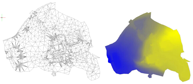
1.Triangulated network (TIN)
Function creates TIN from set of points. User has the option to define breaklines.
2. Longitudinal / Cross section profile
Creates a profile from section of TIN. At first, function requests your choice, whether you want New profile or Select 3D curve. If you select New profile, then you must specify the type of surface, from which you want to create the profile: TIN / 3D surface.
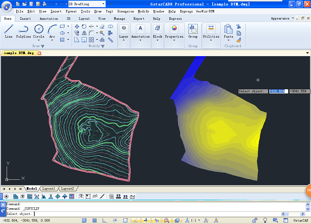
3. Contours
Creates contour lines or smoothed surface in sketch from TIN. User must select already created TIN, then, this window pops-up.
4. Volume calculation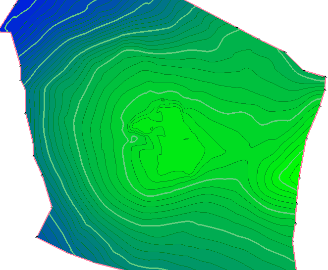
Calculates volumes between two TINs, or between TIN and a comparative plane. The main model of the terrain is able to be refined (reduced) by closed curve. Then, only the volume of this area is calculated. Calculation shows volume above and under comparative plane (model). The calculation can be saved into a file.
5. Editation of TIN
Users can operate Correction of vertex-height of TIN, Removal of TIN vertex, Removal of triangles from TIN (hole), Adding a vertex to TIN, 3D offset of line, Transfer arc to 3D curve, Transfer of line segments to closed 3D curve, Determination of point height in TIN, Curve simplification to edit TIN.
6. Color gradient fill
Fills the triangular mesh (TIN) with 2 color gradient (object type hatch) in 3D space. In Settings, GeoWin-DTM can define a color for the lowest and the highest point of the mesh. The function then interpolates the individual triangles and colors.
- What’s New
1. Creating TIN -Triangulated Irregular Network
The sketch should be prepared for the correct creation of triangulated network.
That means: removal of all points, which negatively affect the elevation course, adjustation of breaklines so they do not cross or overlap each other. The program tries to notice and fix all these encounters, however, it is forced to remove few edges from the process sometimes.
If the sketch contains islets (holes), it's advised to draw their circumferences with 3D curve in individual layer. As an input set of points, following are usable: coordinates from file, or coordinates of objects (POINT type or BLOCK type). Accuracy of these coordinates is reduced to three decimal places, for better manipulation with breaklines, which also participate in
triangulation with their coords. It's possible to use triangulation only with breaklines, without set of points.
2. Creation of contours
Algorithm for smoothing out TIN is sensitive to arrangement of input set of points.
TIN should have its triangles, as similar to equilateral ones as possible, which is sadly very unlikely. Introduction of breaklines makes the situation even worse, because of often creation of obtuse triangles, which contribute to serratedness during the creation of contours. It's also advised
to be careful, and not forget to set sharp breakline, because forgetting it might cause the overcrossing of contour.
3. Computing difficulity
Algorithm for creation of contours is optimalized for cca 10 000 points, when rendering takes less than one minute (smoothness level 1). Theoretically it's possible to compute unlimited number of points, however the application is limited by the amount of available RAM. Increasing
level of smoothness and number of points increases memory requirements. So it's possible that program shuts itself, because of lack of memory, when computing very large number of points (hundreds of thousands).